
December 2013 brought two important anniversaries for GPS, a technology that has changed the world, yet both milestones have gone unnoticed in the media.
The Pentagon authorized GPS development 40 years ago on Dec. 17, 1973. If GPS were a person, we might celebrate its arrival at the threshold of middle age with the dark humor seen on 40th birthday party decorations (tombstones, skulls, etc.), but as a technology, it is young, robust and growing. The potential longevity of GPS is looking more like that of electricity—a vital public utility that 100 years from now will still be powering applications used by just about everyone, everywhere.

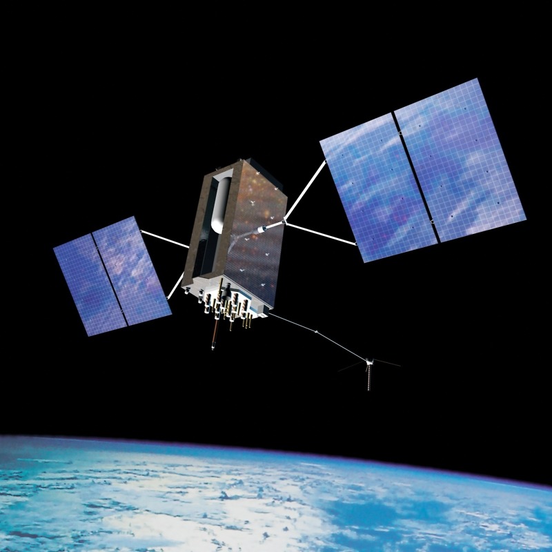
The next-generation GPS III satellites will begin launching in 2015. (Courtesy National Coordination Office for Position, Navigation and Timing)
For a variety of reasons that you can read about in the new book, “GPS Declassified: From Smart Bombs to Smartphones,” which I coauthored with Richard Easton, it took two decades to complete the system. The Pentagon certified Initial Operational Capability on Dec. 8, 1993—a promise of reliable accuracy that immediately affected shipping and transportation.
In the 20 years since, uses of GPS for positioning, navigation and timing (often lumped together as PNT) have proliferated beyond all expectations, and the technology now touches everyone in ways most people do not realize.
Whether we put 20 or 40 candles on the GPS cake, it’s a good time to reflect on its contributions and consider its future.
Want to dig deeper? Take this GPS Anniversary Quiz
Like millions of people, you routinely use GPS apps in your car, smartphone or tablet. But how much do you know about the technology’s history and societal impact? Find out with this quick quiz, and learn more in the answers below.
1. President Ronald Reagan declassified GPS for civilian use in 1983.
(a) True (b) False
2. During the 1991 Persian Gulf War, the United States used how many GPS-guided missiles?
(a) none (b) 7 (c) 42 (d) 288 (e) 210,000
3. The military sometimes disrupts GPS signals during terrorism threats.
(a) True (b) False
4. Which of the following do not use GPS?
(a) bankers (b) farmers (c) golfers (d) surveyors (e) all do
5. A complete disruption of GPS service could cost the U.S. economy how much per year?
(a) $12 billion (b) $24 billion (c) $48 billion (d) $96 billion (e) $192 billion
6. The government can use GPS satellites to track users wherever they go.
(a) True (b) False
Answers:
1. (b) False. President Reagan encouraged the use of GPS for civil aviation after the Soviet Union shot down a South Korean commercial airliner that strayed over its airspace, killing all 269 passengers and crew, but the six GPS satellites orbiting in 1983 were already broadcasting both encrypted military signals and civilian signals.
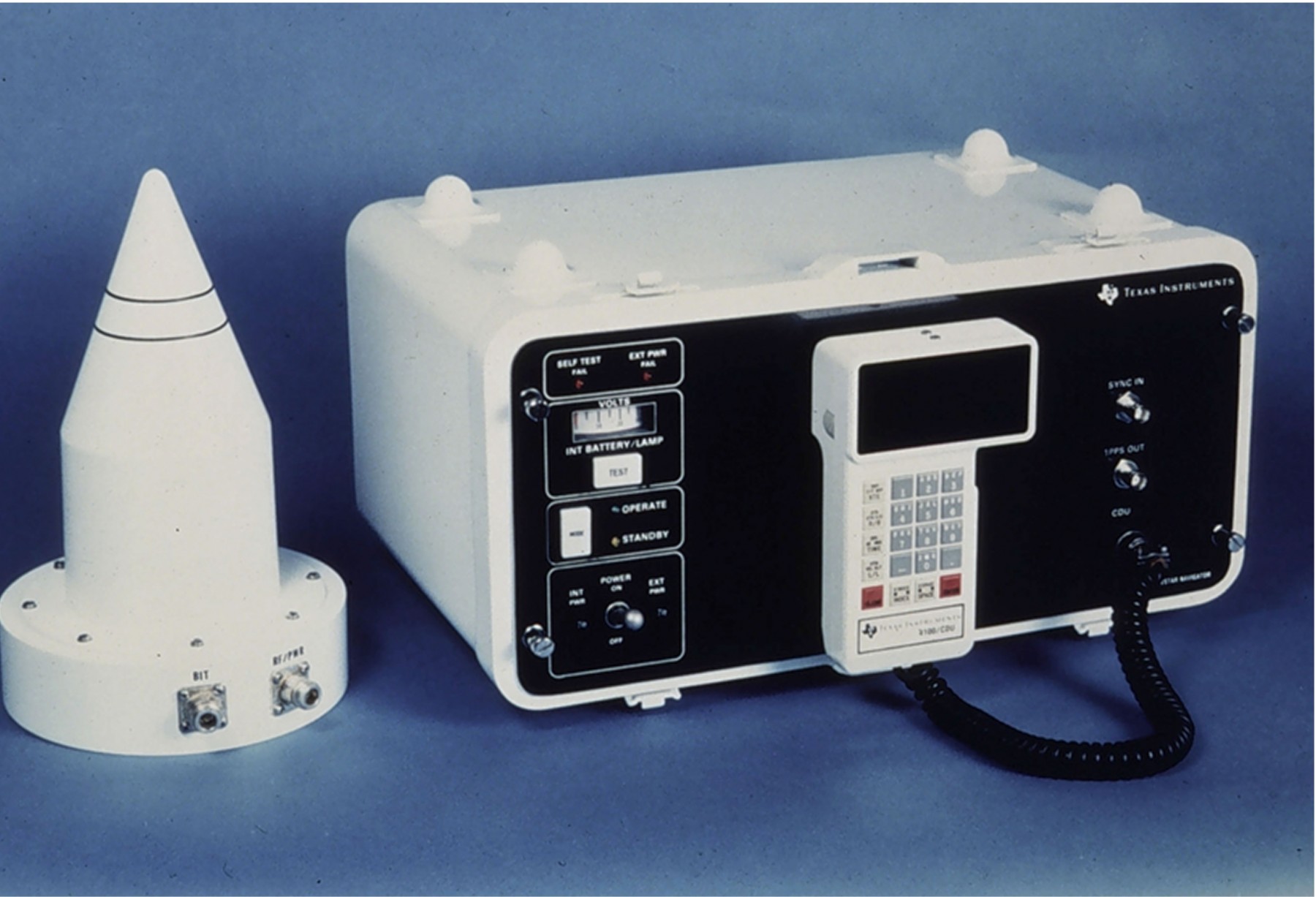
Texas Instruments began marketing the commercial TI 4100, known as the “Navstar Navigator,” in the early 1980s. (Courtesy Texas Instruments)
The first commercial GPS receivers were marketed a year earlier, in 1982, primarily to land surveyors. Some early documents were originally secret but later declassified, while other aspects of the system have always been public knowledge. Dual military and civilian use of GPS was planned from the outset, but civilian agencies, such as the Federal Aviation Administration and Department of Transportation, and private users, such as the airlines and shipping industries, waited to invest money in the technology until after the military proved that the government-funded system worked. Of course, many military aspects of GPS remain secret, and the system is ultimately under the control of the National Command Authority, meaning the president, as commander-in-chief, and the secretary of defense.
2. (c) 42. The Air Force fired 35 Conventional Air Launched Cruise Missiles (CALCMs), and the Navy fired seven Standoff Land Attack Missiles (SLAMs). It was the combat debut for both GPS-guided weapons, and supplies were few.
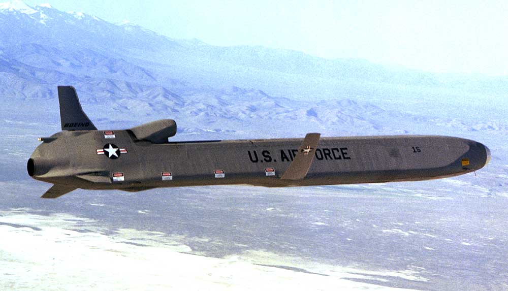
The first GPS-guided missiles used by the Air Force were modified AGM-86B cruise missiles with conventional
bombs replacing nuclear weapons, but they looked identical. (USAF photograph)
In fact, the GPS constellation was incomplete when Saddam Hussein invaded Kuwait on August 2, 1990, oddly enough, the same day that the Air Force launched the fourteenth GPS satellite. Two launches (already scheduled) over the following three months brought the total to sixteen—still five short of the bare minimum needed for global, round-the-clock service. However, by tweaking the placement of some satellites and shortening the usual testing periods of the new ones, ground-control technicians were able to establish two-dimensional GPS service for land and sea operations nearly 24 hours per day and three-dimensional service for aircraft operations about 16 hours per day over the Iraqi theater.
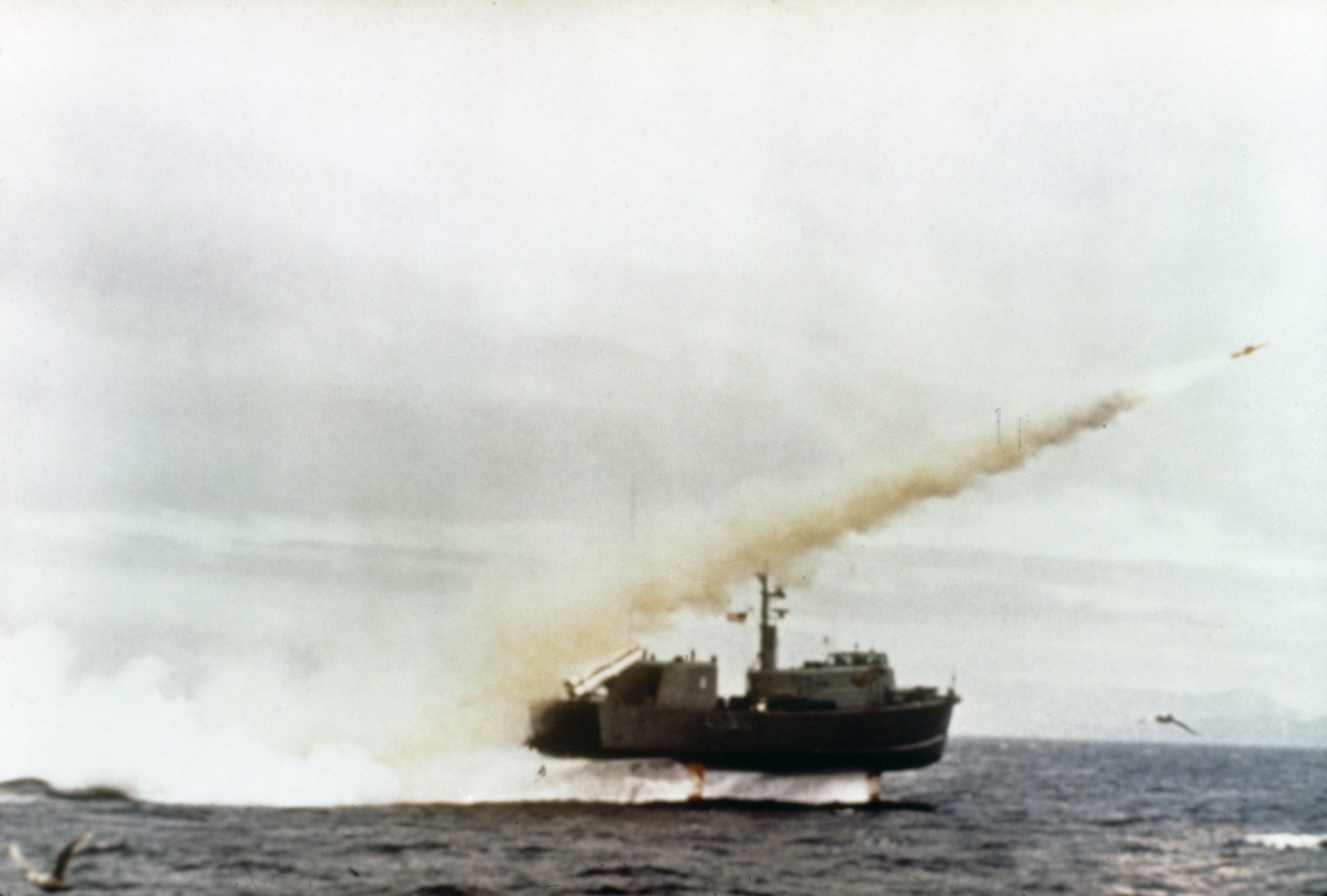
The Navy’s first GPS-guided missile, the AGM-84 was a modified Harpoon anti-ship missile, later also deployed from aircraft. (U.S. Navy photograph)
In a televised war that popularized “smart bombs,” viewers saw no GPS-guided missiles in action. Instead, millions watched the fiery shipboard launches of Tomahawk Land Attack Missiles (TLAMs, 288 used), guided by preprogrammed terrain contour maps, and precision strikes by aircraft-launched, laser-guided bombs diving down rooftop airshafts (9,342 used). Where GPS made a huge difference was in guiding bombers more precisely to their targets, which raised the effectiveness of “dumb” bombs (about 210,000 used), and helping ground forces navigate the featureless desert during sandstorms without shooting each other. After the war, the Pentagon began integrating GPS into every weapons system, and with Full Operational Capability certified in 1995, commercial interest surged among users in all transportation segments.
3. (b) False. President Bill Clinton signed an executive order turning off the security feature known as Selective Availability on May 1, 2000. Since then, the military has never intentionally reduced the accuracy of civilian GPS signals, not even following the terrorist attacks of September 11, 2001. When the military first started “dithering” the civilian signal in March 1990, Selective Availability reduced civilian GPS accuracy to about 328 feet (100 meters), compared to military accuracy, which was about 38 feet. However, various methods were already being developed to make GPS receivers more accurate, such as retransmitting signals from known reference points on the ground, which offset variability (errors) in the signals from space. When the Persian Gulf War loomed, the government turned off Selective Availability, and the Pentagon ordered 10,000 civilian receivers to compensate for a lack of military receivers. The Air Force reactivated Selective Availability after the war, fearing enemies could use GPS to create a “poor man’s cruise missile.” As civilian GPS use expanded and augmentation networks built by the Coast Guard and Department of Transportation made Selective Availability less effective, policymakers recommended ending it. Opening public access to more accurate signals sparked a boom in consumer and nonmilitary GPS applications that continues to this day, and GPS accuracy has steadily improved. An FAA study found horizontal accuracy with good receivers to be within 2.1 meters 95 percent of the time, and often within 1 meter. Some users, such as surveyors, can take advantage of specialized techniques that shrink the error to millimeters.
4. (e) all do. GPS has become a vital public utility for a range of commercial, recreational and personal uses too long to list here. From its military roots guiding jet pilots, ships and missiles, innovators have adapted it for precision farming; surveying, grading and excavating; managing truck and bus fleets; and tracking everything from pets to parolees to Alzheimer’s patients. Environmental scientists use GPS to monitor earthquake fault lines and endangered species. Civil engineers use it to monitor the stability of bridges. Municipal workers use GPS smartphone apps in the field to map infrastructure, such as utility poles, and fire departments keep track of fire hydrant locations to make finding them easier in deep snow. Boston offers a downloadable app that uses GPS to detect and map pothole locations and rough pavement in real time as users travel Boston’s streets. IT managers purchase GPS timing receivers and use the government’s orbiting atomic clocks to synchronize digital networks, power distribution grids, stock exchanges and bank ATMs instead of having to own and maintain their own atomic clocks. From cars and phones to golf range finders and runner’s sports watches, individuals are rarely far from a GPS application.
5. (d) $96 billion. The most thorough study of GPS and the economy to date, The Economic Benefits of Commercial GPS Use in the U.S. and the Costs of Potential Disruption, published in June 2011, by NDP Consulting Group, estimated that a complete loss of the system would cost the U.S. economy $96 billion annually. That same study estimated that commercial GPS users in the United States enjoyed between $68 billion and $122 billion annually in economic benefits through productivity gains and lower input costs.
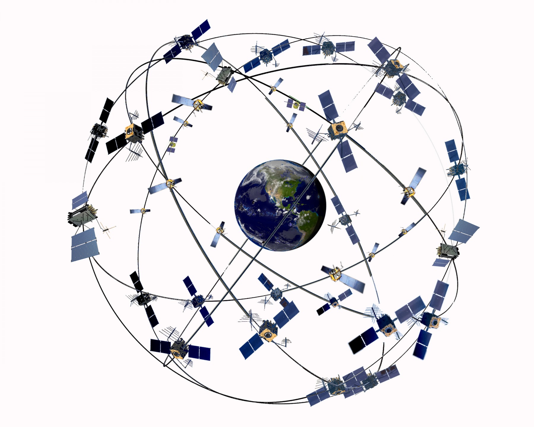
An artist’s stylized rendering (not to scale) of the GPS constellation after GPS II satellites join the mix. (Courtesy Lockheed Martin)
Through 2010, U.S. taxpayers had spent roughly $35 billion on the GPS constellation, with ongoing annual outlays nearing $1 billion a year. Even without considering the value of GPS to the military and economic activity associated with the defense industry, the commercial benefits represent an impressive return on investment. As sequestration strains military budgets over the next few years, public appreciation for these commercial benefits could play a crucial role in maintaining and upgrading GPS. To meet promised accuracy 95 percent of the time anywhere in the world, the GPS constellation requires 24 satellites, including three spares. Because older satellites have lasted longer than expected, no fewer than 27 and as many as 31 operational satellites have remained in orbit over the past seven years, yielding better service that users have come to expect. Replenishment with new satellites and a next-generation ground control system are behind schedule and over budget, but scaling back GPS is not like cutting defense spending after ending a war. Its dual military and civilian roles and long lead times for development and launches make it a component of U.S. infrastructure that cannot be neglected.
6. Trick question. GPS satellites by themselves cannot track anything. They broadcast signals passively, as radio stations do, to an unlimited number of receivers. Once a receiver processes GPS signals to pinpoint its location, that information can be tracked using separate wireless technology. The Supreme Court ruled in 2012 that police must get a warrant to attach GPS trackers to vehicles, but with U.S. smartphone penetration approaching four in five people, you likely have a GPS-enabled tracker in your pocket. Law enforcement agencies make more than a million requests for consumer cell phone records each year, seeking the same location data that customers authorize wireless carriers to sell to advertisers. Remember that next time you walk into a mall, and your cell phone buzzes with an instant coupon from your favorite store.
![]()

