

Mapmakers everywhere must have breathed sighs of relief when they learned they would not have to redraw the United Kingdom to reflect an independent Scotland. History suggests they should remain at the ready.
Coming just a week after an effort to split California into six states failed to garner enough signatures for the 2016 ballot, cartographers may be tempted to let down their guard, but these are only small reprieves in the otherwise ceaseless shape-shifting of political borders and names.
The global pace of unrest and referenda seems to have accelerated lately, or maybe the world is just reverting to average after an unusually long period of stability following World War II. Forecasting what’s next is roughly as difficult as predicting earthquakes—we know where tectonic boundaries are and which way plates are headed but not whether they will slide gradually past each other or rupture in a massive jolt.
One such jolt happened with the collapse of the Soviet Union in late 1991. The previous year had brought rumblings when East and West Germany united. (Also in 1990, North and South Yemen united, and Namibia left South Africa.) The USSR breakup spawned 15 sovereign countries—Armenia, Azerbaijan, Belarus, Estonia, Georgia, Kazakhstan, Kyrgyzstan, Latvia, Lithuania, Moldova, Russia, Tajikistan, Turkmenistan, Ukraine and Uzbekistan. That same year, Micronesia and the Marshall Islands became independent of the United States. Between 1991 and 1994, Yugoslavia split into five nations—Slovenia, Serbia and Montenegro, Macedonia, Croatia, and Bosnia and Herzegovina. Czechoslovakia split into Slovakia and the Czech Republic. In 2006, Montenegro voted to leave Serbia, and two years later, Kosovo declared its independence from Serbia. Altogether, since 1990, mapmakers have had to redraw the lines and names for 34 new nations.
Most Americans cannot locate these places on a map or globe and never give a thought to how often the people who make these products have their work undone by political turmoil. When the Soviet Union broke up, I owned a bookstore and sold globes, which had been popular as Christmas and graduation presents. I remember the globe companies having to send tags and stickers with guarantees for a free replacement, if mayhem rendered them out-of-date.
The globe’s newest nation, officially, is South Sudan, which voted to secede from Sudan in 2011. That’s if you don’t count the disappearing border between Syria and Iraq—declared by the Islamic State and acknowledged by Pentagon brass.
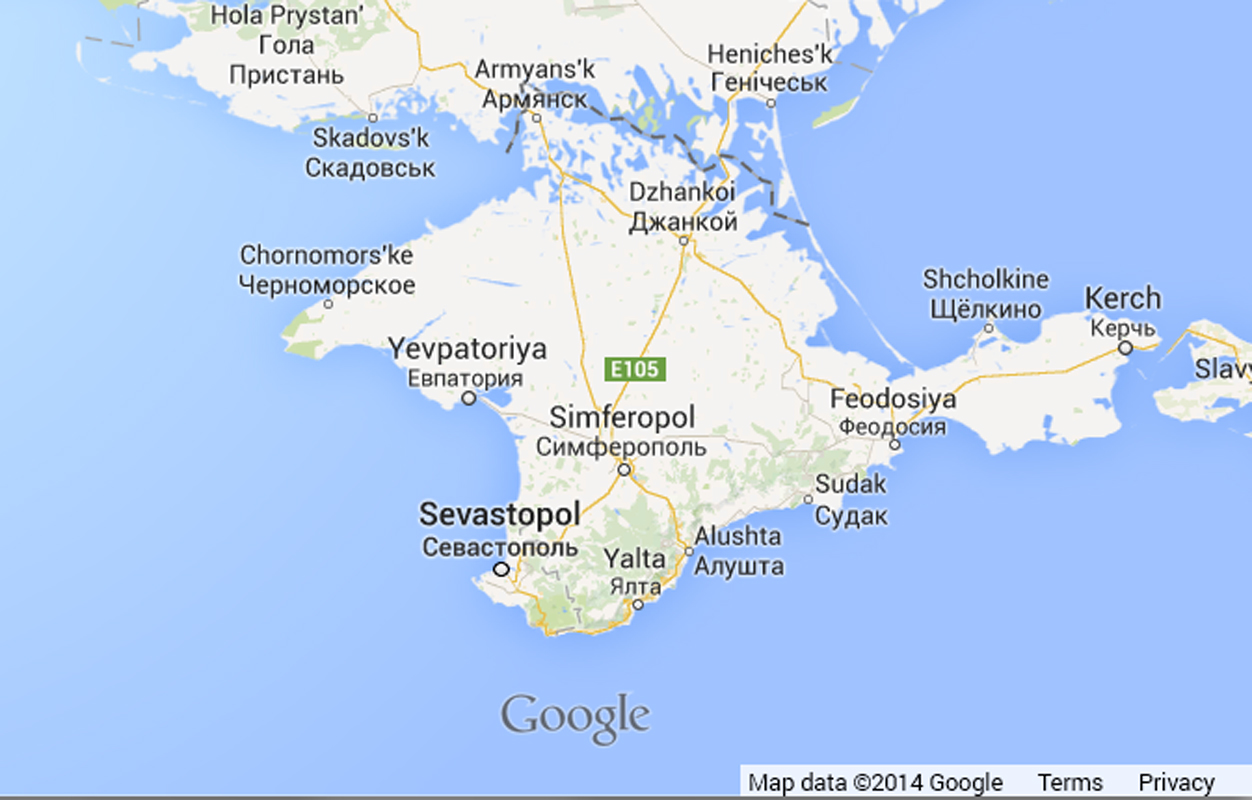
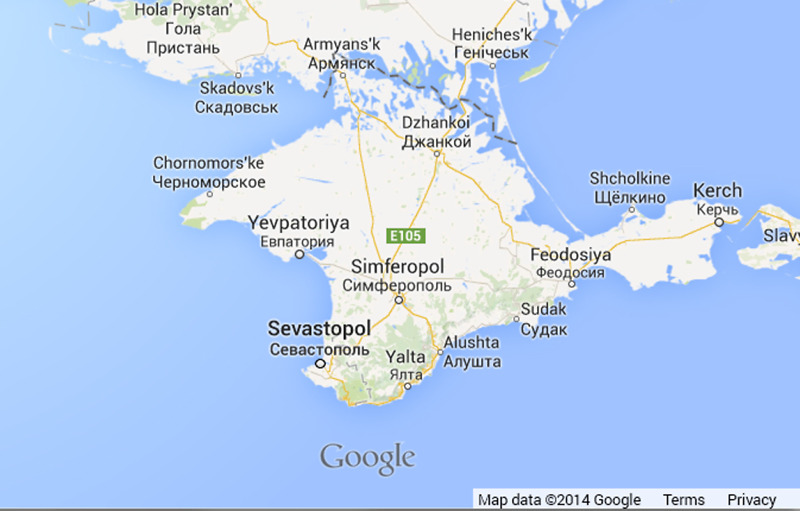
And then there is Crimea, where I guess we could say that the ink is not quite dry. After seceding from Ukraine in a controversial March 16 referendum and being annexed by Russia, it is currently recognized by only 15 U.N. member states.
If you were preparing to print a map or produce a globe today, how would you handle such locations—with a bunch of asterisks and notes printed in the Pacific Ocean? To paraphrase a song, “it’s getting hard out there for a mapmaker.”
Thank goodness for the invention of digital maps, which can be refreshed or revised in a flash. They seem wholly suited to the ephemeral nature of our political geography.
![]()