

Mountain climbers famously do their thing “because it’s there,” but shutterbugs visiting the tallest peaks often find their views obscured by mountains playing peek-a-boo with clouds.
In September my wife and I visited two of our nation’s mightiest mountains and learned that both are so immense they influence their own weather. We spent considerable time and money journeying to these majesties. So, like ancient petitioners visiting royals, we approached both hoping the clouds would part and grant us a viewing.
Mount McKinley
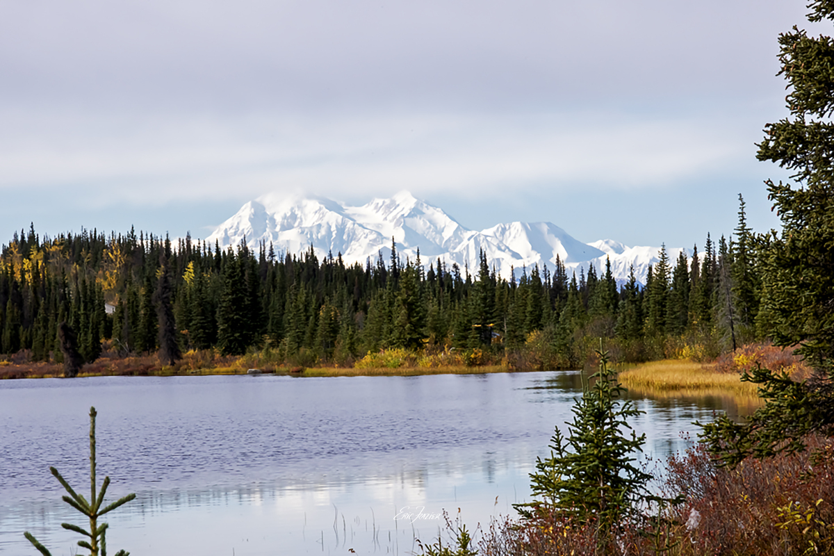
Denali National Park’s Mount McKinley in the Alaska Range has the tallest peak (20,310 ft.) in North America. The “tall one” (deenaalee in native Koyukon language) dominates the 600-mile range. The mountain remains snow-covered year round, and glaciers cover 16% of the 6-million-acre national park. Access consists of one asphalt road and one railroad.
Most visitors arrive via train as part of cruise-tours operated by Holland America and Princess (both owned by behemoth Carnival). We were among the last group to visit the Denali resort in mid-September (a rainy month) before everyone packs up and leaves for winter. Souvenirs in the gift shop remind shoppers that only 30% of visitors see the mountain during their three-day visit.
Our official park tour took us to Inspiration Point, where the peak rises behind several ridges. White clouds collected on the southern slope, and because the mountain stays snow-covered year round, it was hard to tell where clouds stopped and the mountain began. We needed a better vantage point.
Captured September 16, 2025, by Eric F. Frazier.
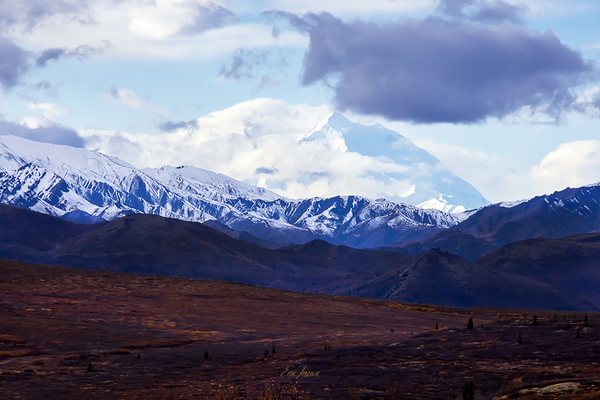
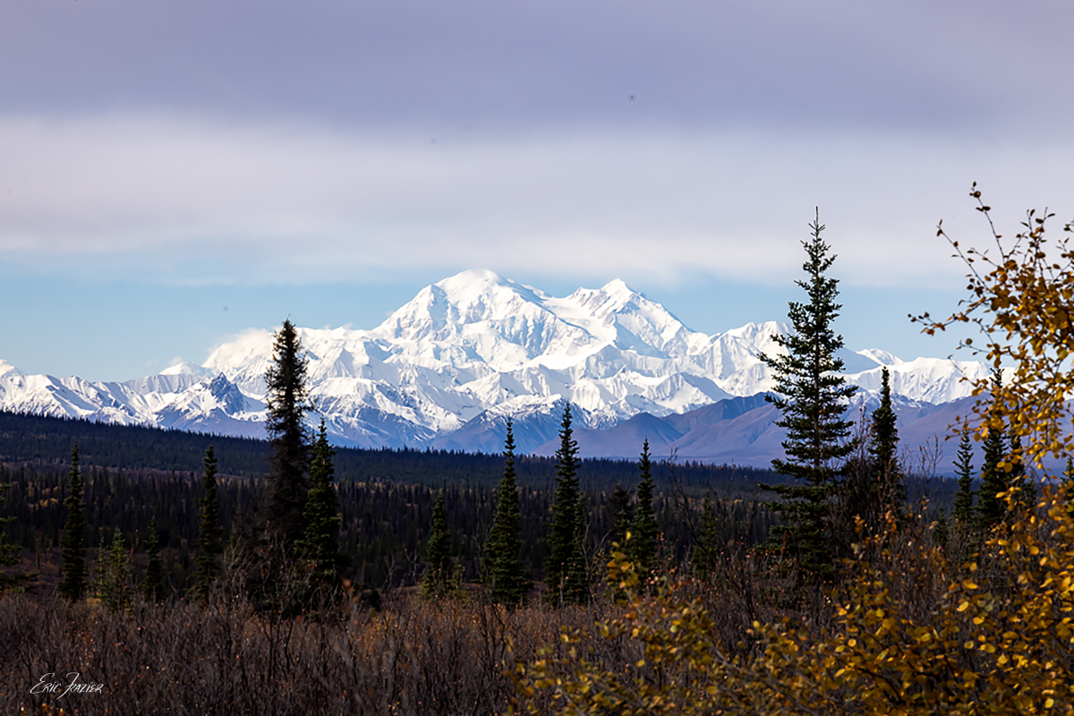
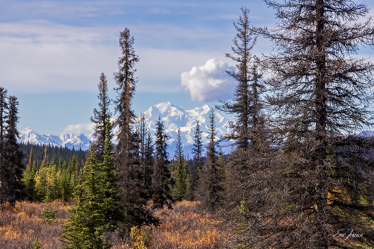
Heading East for a Better View
The next day, we hired a local guide, who drove us 40 miles east on the unpaved Denali Highway. From this high plateau, where the road hugs a ridge above the Monahan Flat, we got a more expansive view of the immense mountain. This distant view was probably better than we could have gotten anywhere inside the park. Lunch at a roadside picnic table with Denali looming in the background was a rare treat.
Captured September 17, 2025, by Eric F. Frazier.
Captured September 17, 2025, by Eric F. Frazier.
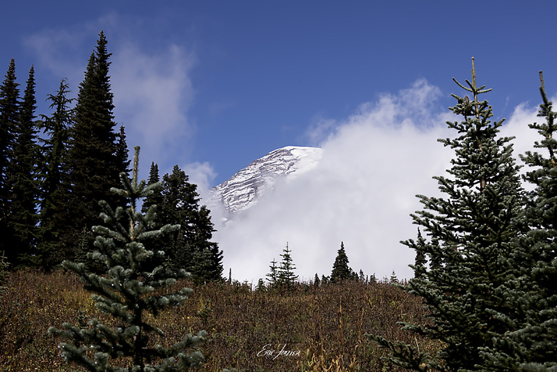
Mount Rainier
Mount Rainier National Park in Washington State lies about 60 miles southeast of Seattle. Rainier is an active volcano and can be seen looming in the distance, weather permitting. Its peak, at 14,411 feet, is the highest in Washington state and the most glaciated in the continental United States. As such, it spawns five major rivers.
From Seattle, our group traveled on a 25-passenger shuttle bus like the ones airport hotels use. The two-hour-plus journey was a bouncy ride, and skies were cloudy the whole way. The forecast called for clearing around 1 p.m. Of course, we hit rain as we climbed the switchbacks and gained elevation around noon.
By the time we reached the Henry Jackson Visitor Center on the south side of the mountain, we could see blue sky. But Rainier’s peak was completely obscured.
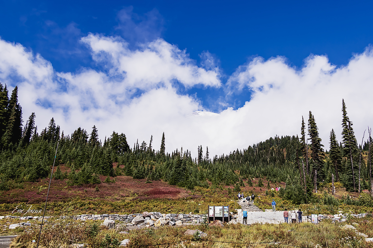
Captured September 21, 2025, by Eric F. Frazier.
Eventually, the fast-moving clouds revealed parts of the mountain—the tip of the peak or a half on one side. We hiked the Nisqually River Trail for a couple miles and had the same results. As our bus descended en route back to Seattle, the driver stopped at Logmire Museum, and we got our best view of the very top. Even so, clouds still obscured much of the mountain.
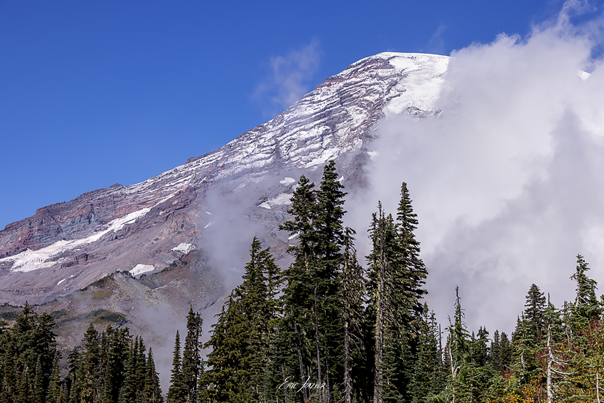
Captured September 21, 2025, by Eric F. Frazier.
Captured September 21, 2025, by Eric F. Frazier.
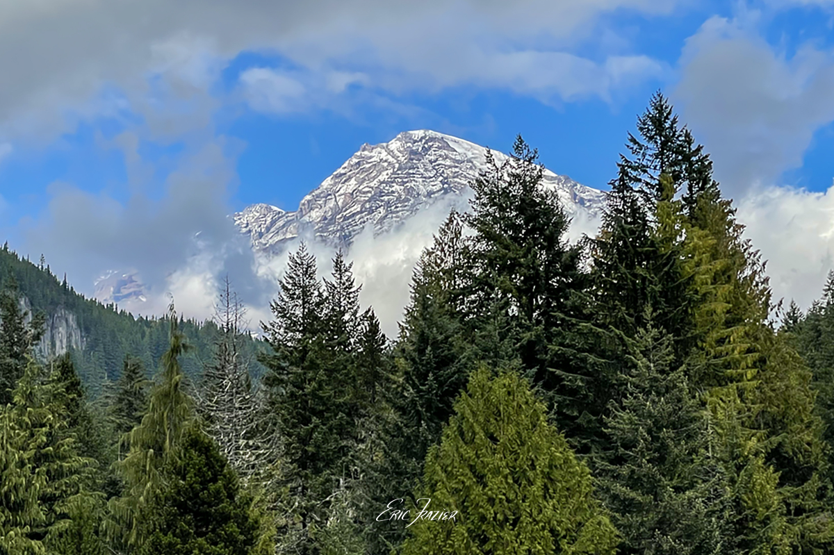
Ultimately, the best view of Mt. Rainier came from Seat 13E on our flight from Seattle back to Raleigh. Clouds, again, command the photograph. But from an altitude roughly eye-level with the fully visible peak, the clouds create a dreamlike collage of the mountain’s vast adjacent ridge lines.
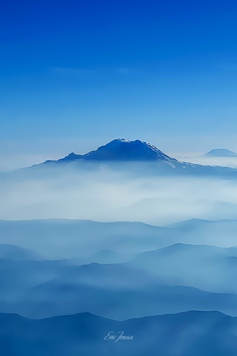
Captured September 23, 2025, by Eric F. Frazier

